
LANSING, Mich. — A small disturbance tracking across Lake Michigan will bring the chance for a few isolated showers this evening, mainly along and south of I-94. Impacts will be minimal, but a some slick spots could develop on the roads where showers develop. Any wet weather wraps up after sunset, leaving partly cloudy skies behind for the rest of the night. Lows will remain chilly in the upper 30s.
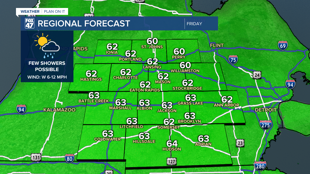
Winds take a more westerly turn on Friday, allowing some slightly milder air to return to our neighborhoods. Partly cloudy skies are expected throughout the day, with just a slight chance for a pop-up shower in the afternoon. Highs will return to the low 60s, with west winds at 6-12 mph. Great weather to get outdoors, including in Eaton Rapids where Fox 47 will be On the Road for this year's Urban Air event!
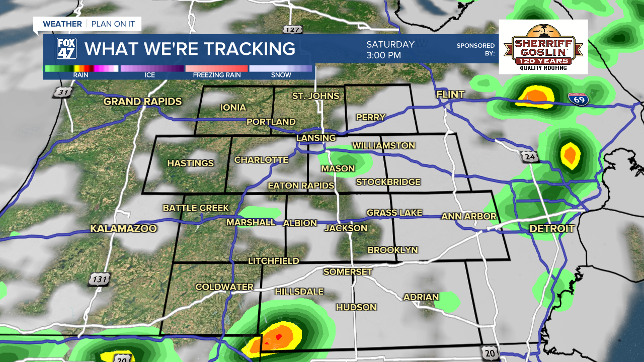
Temperatures climb a little higher on Saturday as a warm front lifts into the region. It will be another day with a mix of sun and clouds, followed by the chance for showers and thunderstorms in the afternoon and evening. Highs will top out in the mid 60s before a cold front cools us off again for the second half of the weekend.
GET YOUR FOX 47 FORECAST HERE
Some good news for Mother's Day, the forest is now trending a bit sunnier with showers now looking to stay out of the picture entirely! Highs will slip back to the upper 50s, but it's shaping up to be a pleasant day for whatever plans you have to celebrate with mom.

An upper-level trough digs in again across the Great Lakes on Monday and Tuesday, holding highs to the middle and upper 50s for the early part of the week. Monday will feature a mix of sun and clouds, followed by a returning chance for showers with a new disturbance on Tuesday.

There continue to be signs that a more significant warmup will head our way during the second half of next week, bringing highs closer to normal for mid-May. Temperatures may even trend above average by next weekend, and signs appear to be pointing to this being a more permanent shift in the overall weather pattern. Stay tuned for updates!
Have a great weather picture or video to share? Send it our way and we may feature it on-air or online!

