
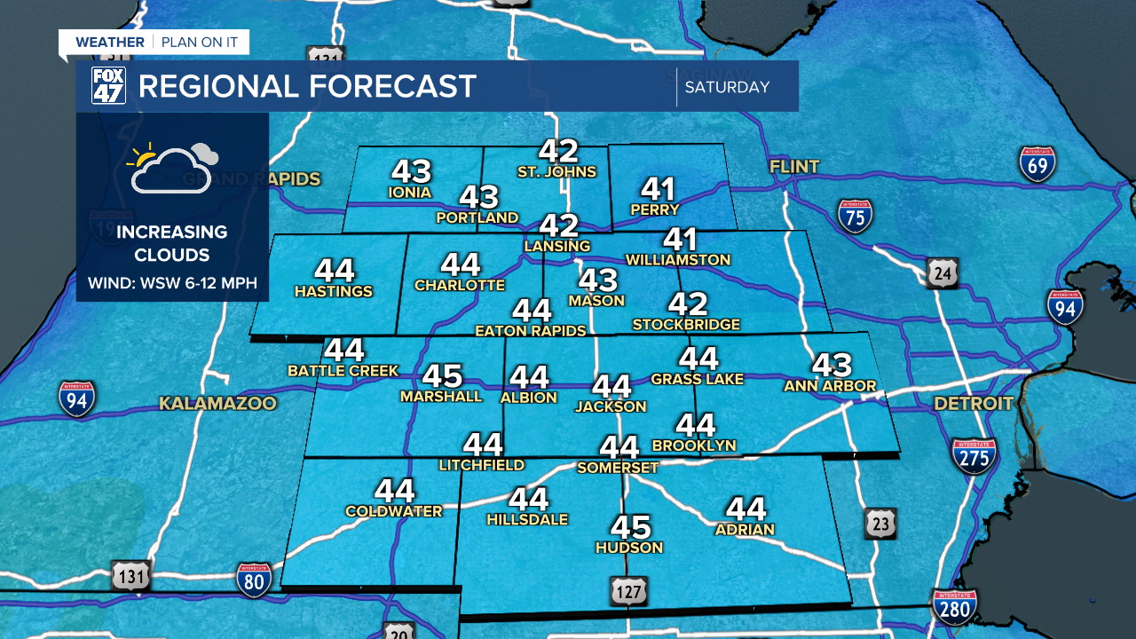
Cold high pressure settles over the Great Lakes and Ohio Valley on today, locking in another day of colder-than-average temperatures. Highs will be held to the low 40s, with clouds increasing during the afternoon. Despite that, conditions will remain dry with WSW winds at 6-12 mph.
GET YOUR FOX 47 FORECAST HERE
We get back to our regularly scheduled Spring weather on Sunday. High pressure will still be close enough to the region for partly to mostly cloudy skies, and still no showers in sight. Continued southwesterly winds will push highs back into the middle and upper 50s.
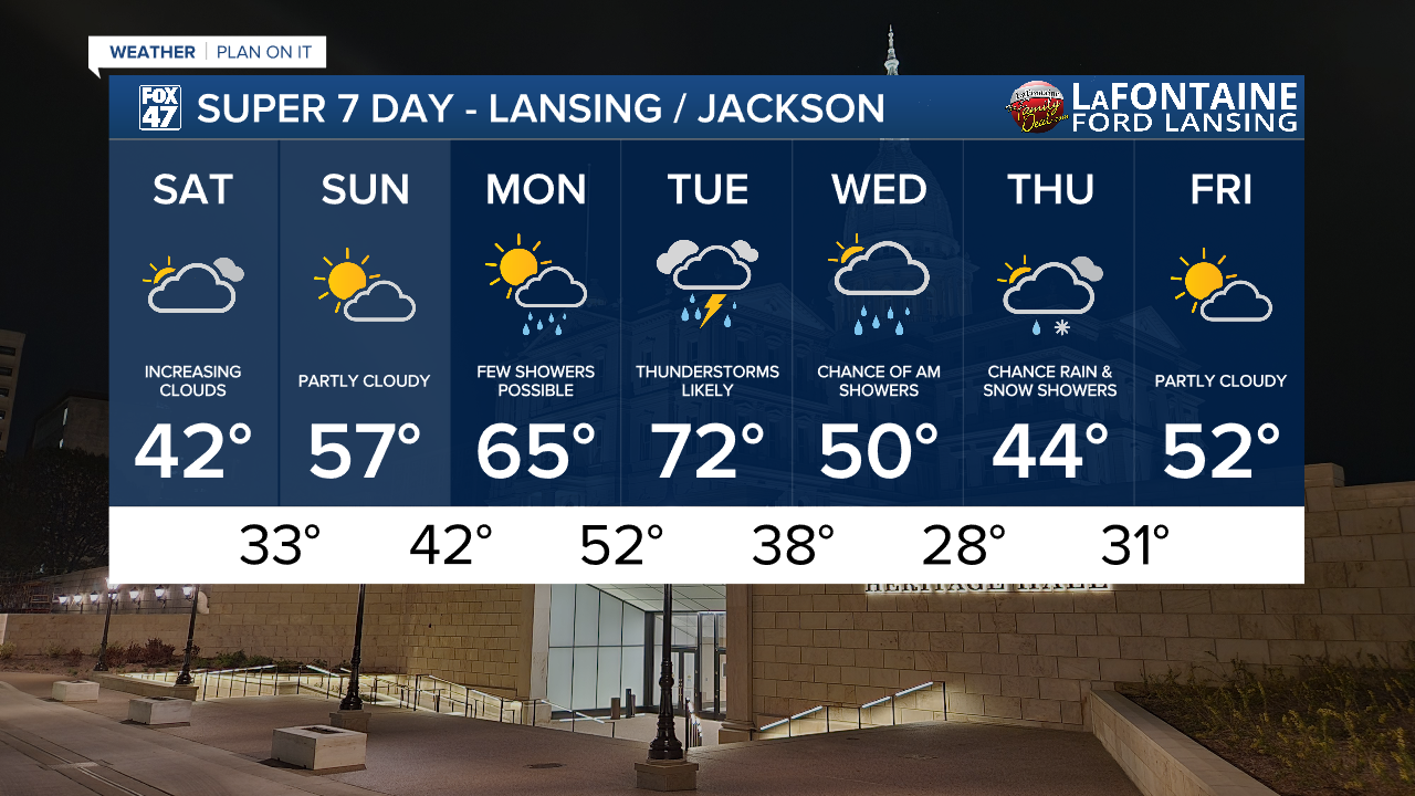
Warming continues into the start of next week, with mid 60s expected on Monday, followed by highs in the low 70s on Tuesday. We'll be keeping an eye out for a few possible showers on Monday, with a greater likelihood of thunderstorms on Tuesday.
Have a great weather picture or video to share? Send it our way and we may feature it on-air or online!

