
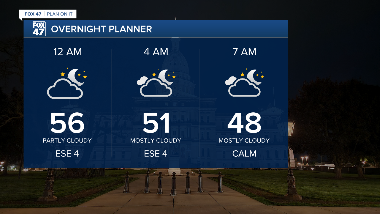
LANSING, Mich. — Partly to mostly cloudy skies will continue overnight as waves of cirrus clouds pass over the Great Lakes. No wet weather is expected, but this will be one of the only nights this week where it actually feels like Fall. Lows will dip to the middle and upper 40s by daybreak, with ESE winds at 4-8 mph.
Clouds will stick around through the early afternoon hours on Thursday, gradually decreasing as we approach evening. Highs will trend slightly warmer, returning to the mid 70s, keeping us close to ten degrees above normal for early October.

We click right back into Summer on Friday and through the upcoming weekend. As our winds pivot toward the south, we'll see another surge in temperatures, while a high pressure ridge keeps our weather dry. Friday through Sunday will bring mostly sunny skies, with highs soaring to the middle and possibly upper 80s!
GET YOUR FOX 47 FORECAST HERE
The southerly winds eventually help to bring a little moisture back to the region early next week, all while a cold front approaches from the northwest. We'll look for a mix of sun and clouds on Monday with the slight chance for a few isolated showers. Additional showers are possible on Tuesday and they may be a bit more widespread, but this rain is not expected to lead to significant drought improvement overall.

Want more FOX 47 News? Here's how you download our Roku app
You can also see the latest news from across our mid-Michigan neighborhoods by liking us on Facebook or following us on X.
