LANSING, Mich. — Temperatures in our neighborhoods today will fall a bit in comparison to yesterday. Lansing did exceed 80 degrees as a high on Monday and now we will start to feel the influence of present moisture.
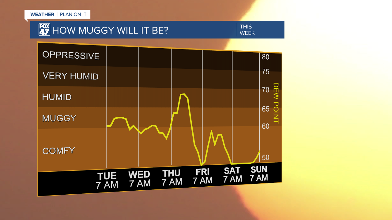
The weakening low continues its slow track north towards the state of Michigan. With it, moisture is being transferred back into our neighborhoods. Dew points today and for the next couple of days are expected to exceed 60. This will allow for some muggy conditions along with the showers and storms that we are tracking.
WATCH THE FULL FORECAST BELOW
Ahead of the surface low, scattered showers and non-severe thunderstorms will develop at around 2 PM this afternoon. daytime heating will help in the development of these showers and storms as we will be looking at high temperatures trends in the mid to lower 70's.
The main impact we could see within the storms will be heavier rainfall rates. Make sure to stay weather aware when heading out the door this afternoon. A similar setup is looking to occur Wednesday with showers and non-severe scattered t-storms as well as the area of low pressure inches closer to Michigan before turning east on Thursday.

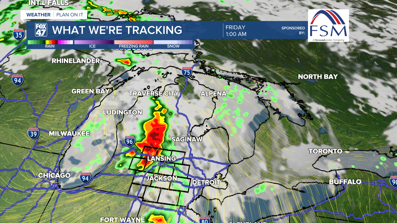
We will turn our attention to Thursday as we are forecasting our next opportunity for severe weather. An upper level trough will make its way towards the Great Lakes region. A surface low will intensify with a cold front expected to advance through our neighborhoods late Thursday evening.
The Storm Prediction Center has issued a level 2, slight risk of severe weather for all of our neighborhoods. All severe impacts at this moment are possible as the line of storms looks to advance past midnight in the overnight hours of Thursday into Friday.
We could still see some tweaks to this forecast before the event occurs as the further you get into the overnight hours and lose peak heating, the more you lose the risk for severe weather. We will be watching closely.
Following Thursday, we will dry out throughout the day Friday with temperatures hovering around 80 degrees. We will cool down heading into the weekend with chances for showers.

We are in severe weather season in Michigan. Make sure to have a plan for if and when severe weather strikes in your neighborhoods.
WATCH BELOW TO LEARN THE DIFFERENCE BETWEEN A WATCH AND A WARNING
Want to learn more about the Weather? Visit the FOX47News Website.
Stay in touch with us anytime, anywhere.
Sign up for newsletters emailed to your inbox.
Select from these options: Breaking News, Severe Weather, School Closings, Daily Headlines and Daily Forecasts.
